


Sullivan County Missouri Cemeteries
The location of Sullivan County, Missouri cemeteries are now easier to find thanks to sources such as Histopolis.Com, a collaborative genealogy and history site focus on map locations for all cemeteries in the United States and Puerto Rico.
Cemetery names in italics are alternate “aka” names.
Cemeteries that have been transcribed or partially transcribed are shown in the menu to the right as well as listed with the information below.
Completed: Links to Find a Grave cemeteries and Histopolis cemetery data has been added to all entries below if they existed. New additions or updates are posted with date.
- Asbury Cemetery ~ Updated: 10/23/2011
Located on Hwy E approximately 7 miles NW of Milan in Section 16, Township 63 North, Range 21 West. It is in the churchyard of Asbury Church.
Histopolis | Find A Grave Asbury List, includes photos. - Bairdstown Church Cemetery ~ Updated: 10/23/2011
Located on Hwy OO 8 miles NW of Milan at Bairdstown Church in Jackson Township; in the SE part of Section 6, Township 63 North, Range 20 West.
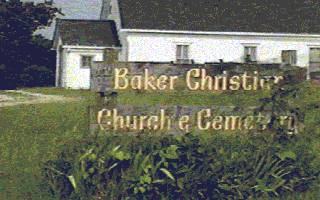
Map | Histopolis | Find a Grave Bairdstown List, includes photos. - Baker Cemetery ~ Updated: 10/23/2011
Located on Missouri State Hwy. V in Morris Township.
Photo | Map | Baker Cemetery Transcription with photos | Find a Grave Baker Listing | Histopolis - Baldridge Cemetery ~ Updated: 7/21/2010
Small family cemetery 10 miles NW of Milan in a pasture about 1/4 mile East of what used to be the home of Ed Murdock ca 1950. It is located in the NW part of Section 31, Township 64 North, Range 20 West in Jackson Township.
» Still no listing as of 10/23/2011 on Find A Grave or Histopolis. - Brackett Cemetery
Located in Section 17, Township 64 North, Range 21 West, adjoining what was the “John Lievasy Farm” (ca 1950), 5 miles east and 1 1/4 miles north of Harris. This cemetery was originally part of the J. M.Tucker Farm. More location details on Histopolis.com | Map | Find a Grave Brackett Listing - Brookshier Cemetery ~ Updated: 10/23/2011
Laid out in 1811 on what used to be the Clayton Warren farm (ca 1950); one mile North of Browning.
Histopolis | Find a Grave Brookshier Listing - “Bunch, Bute, Rosehill” Cemetery ~ Updated: 6/1/2011
This cemetery, located south of Green City, has no towns within 10 miles. Take 129 South and turn right on Table Road. More location details on Histopolis.com where it is listed as Bunch Cemetery.
Map | Find a Grave Bute-Bunch-Rosehill listing; Bunch only; Bute only; Rosehill only | Cemetery Transcription - Burnett Cemetery ~ Updated: 7/21/2010
Located 6.9 miles north of Unionville and 7.1 miles west of Pollock. More location details on Histopolis.com.
Map | Find a Grave Burnett listing - Busby Cemetery) ~ Updated: 7/21/2010
Located on Hwy KK in Section 13, Township 64 North, Range 22 West and 2 1/2 miles northwest of Newtown and 3.2 miles southwest of Harris. More location details on Histopolis.com.
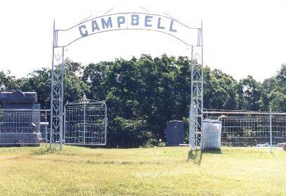
Map | Find a Grave Busby listing - Campbell Cemetery ~ Updated: 7/21/2010
Eli Campbell donated the land for this cemetery near the end of the Civil War. It is located 3 miles SW of the town of Pollock near Fairview Church. More location details on Histopolis.com.
Map | Find a Grave Campbell listing | Photo | Cemetery Transcription - Deed's Cemetery ~ Updated: 7/21/2010
Now known (locally) as the Liberty Union Cemetery and located at the Liberty Union Church, which is 6 miles SW of Pollock in Section 64, Township 63 North, Range 20 West, 0.4 miles W of Hwy 5 (the Charles Reeves Farm ca 1945).
Directions: The cemetery is located behind the Liberty Union Baptist Church, north of Milan, Missouri. The easiest way by black top is to go west on Highway 136 out of Unionville, turn left on EE, wind through the country a ways until you see BB, and turn left. Drive (quite a ways) until you see the "Liberty Union Baptist Church" sign and turn left on gravel. The church is just down the road on the left side. The cemetery is directly behind the church and has the name clearly stated on its gate. It is located on a hill, with a slightly rough climb to it. If you have difficulty with hills, it is suggested not going alone. ~ Directions provided by Marsha Sears.
Find a Grave Deeds listing | Cemetery Transcription - Deep Springs Cemetery
Located on Hwy T 5.1 miles SE of Milan in Section 35, Township 62 North, Range 20 West. See Histopolis.com for more location details.
Map | Find A Grave Deep Springs listing | Cemetery Transcription ~ Major Update: 11/8/2010; Error correction & new entry: 12/13/2010 - Elmwood Cemetery ~ Updated: 10/23/2011
Located North of Milan, Missouri. More about the Elmwood Cemetery.
Find A Grave Elmwood Listing - Embertson Cemetery ~ Updated: 10/23/2011
Small community cemetery located on what used to be the Kenneth Bankus farm ca 1950, in the NE part of Section 6, Township 62 North, Range 19 West in Polk township; 3 1/2 miles East of Milan. This cemetery was neglected for years and several of the plots are missing headstones and many of the existing headstones are unreadable. No listing on Histopolis or Find A Grave as of 10/23/2011. - Fields Cemetery ~ Updated: 10/23/2011
This is a small family cemetery located in a pasture East of the “Old Field's Mill”, a landmark for many years. The Fields Mill was the second to operate in Sullivan County, owned by pioneer Samuel R. Fields and begun in 1844. The cemetery is located South of Reger, in Section 8, Township 61 North, Range 20 West. More location details on Histopolis.com | Find A Grave Fields Listing | Cemetery Transcription - Gilbert Cemetery ~ Updated: 10/23/2011
Located 2.4 miles West of Pollock. More location details on Histopolis.com and Find A Grave Gilbert Listing - Glaze Cemetery ~ Updated: 10/23/2011
Located 5.2 miles west of Humphreys of Redwood Road. More location details on Histopolis.com. Find A Grave Glaze Listing - Gramling Cemetery ~ Also known as the Marley Cemetery - located in the NE part of Section 22, Township 62 North, Range 20 West; about 2 miles South of Milan by the side of the road; The site used to be the Marley Farm circa 1953.
Cemetery Transcription - Green Castle Cemetery ~ Updated: 6/3/2011
Also spelled as Greencastle, located on Highway 6 on the eastern edge of the town of Green Castle in Section 13, Township 63 North, Range 18 East. More location details on Histopolis.com.
Cemetery Transcriptions | Find A Grave Map & Green Castle listings. - Green City Cemetery ~ Updated: 6/3/2011
Located off 129 in .5 miles north of Green City. More location details on Histopolis.. Also see Find A Grave Map & Green City listing. - Haines Cemetery ~ Updated: 10/23/2011
No towns within 10 miles of this cemetery. This appears to be a family cemetery. Located south of Green City. See location details on Histopolis.com.. No listing on Find A Grave. - Haley Cemetery ~ Updated: 10/23/2011
Located 2.2 northeast of Galt. See more location details on Histopolis | Cemetery Transcription. Find A Grave Haley Listing. For possible updates, see also link to Haley Cemetery, Grundy County (Provided by Larry Flesher.) - Hamilton Cemetery (Hamilton/Grindstaff) ~ Updated: 10/23/2011
From Boynton, on N Hwy, go .8 miles to Fourm Drive. Take a right (from here to the cemetery it is gravel/dirt road). Go about .1 mile and take a right between the house and the shed. Follow the road, about .1 mile, to the cemetery, which is on the right. More location details on Histopolis. Two listings on Find A Grave: Hamilton Cemetery, over 40 interments and Hamilton #2, 1 interment. - Hannah Cemetery ~ Updated: 10/23/2011
Located 4 miles East of Highway 129 and 6 miles South of Green Castle, in Section 14, Township 62 North, Range 14 West.
Find A Grave Hannah Listing | Cemetery Transcription [Moved from a Word document into PDF by the originator, Debbie McKim, updated 30-May-2011 ~ Posted 10/20/2011. - Harris Cemetery ~ Updated: 10/23/2011
Located northwest of Harris off Y/E Hwy. More location details on Histopolis. Over 1,000 interments listed on FindAGrave Harris Listing. - Harrison Cemetery ~ Updated: 10/23/2011
Located on what used to be the Dean Smart farm (ca 1950) four miles West of the town of Pollock. No listing on Histopolis or Find A Grave. - Hatcher Cemetery ~ MAJOR Update: 10/23/2011
Small family cemetery located on what used to be Jerry Hedges farm ca 1955; 1/4 mile west of the Kenny Hedges Farm & 3 1/2 miles NW of Browning.
Cemetery Transcription (Major Changes) | Histopolis | FindAGrave Hatcher Listing - Hawkeye Cemetery ~ Updated: 10/23/2011
Located 1/2 mile NW of Green City in Section 11, Township 63 North, Range 19 West.
Directions: Hwy 6 to Green City, Mo. Then North on Hwy 129 to State Hwy N, West to Shady Rd., North to Gold Dr., East to Hawkeye Cemetery. ~ Thanks to Carol Foster for the update.
Histopolis | Map | Find A Grave Hawkeye List, includes some photos. - Head Cemetery ~ Possibly called Locust Valley, see transcription ~ Updated 10/22-23/2011
Located on the West side of Ember Road, Northeast of Browning, Missouri in Township 61North, Range 20W, Section 22.
Cemetery Transcription ~ Updated | Find A Grave Incorrect attributed to McCulla Cemetery - Henry Cemetery ~ Updated: 10/23/2011
Located about 2 miles South of Reger in Section 36, Township 62 North, Range 21 West.
Histopolis | Map | Find A Grave Henry List (over 300 interments), includes some photos. - Hickory Grove Cemetery ~ Updated: 10/23/2011
Located in the NW quarter of the NW quarter of Section 29, Township 62 North, Range 19 West, near the Mount Moriah Primitive Baptist Church, about four miles east and 3 miles south of Milan, and about one mile north of Spencerville in Pleasant Hill Township. Histopolis | Map & Find A Grave Hickory Grove Listing - Holliday Cemetery ~ New: 10/20/2011
Located in Jackson Township, 3.1 miles northeast of Pollock. Originally started by the family of Dr. George Reading & Sarah T. (Mahill) Holliday. Incorrect spelling, Holiday, is often seen including these two links: Holliday Find A Grave Listing | Histopolis - Hollon Cemetery ~ Updated: 10/23/2011
Located NE of the town of Browning.
Cemetery Transcription | Histopolis | Find A Grave Hollon Listing - Hoover Cemetery ~ Updated: 10/23/2011
Located north of Browning going west from Browning 1/2 mile, then north one mile, and east off the road nearly 1/2 mile in Section 30, Township 61 North, Range 20 West. As of 1951, the cemetery was fenced.
Histopolis | Cemetery Transcription | Hoover Find A Grave, includes pictures and map. - Humphreys Cemetery ~ Updated: 10/23/2011
Located on the North side of the town of Humphreys in Section 36, Township 62 North, Range 22 West. Find A Grave Humphreys Listing, over 500 interments. - Hurst Cemetery ~ Updated: 10/23/2011
Used to be known as the Staggs Farm in the 1950's; it is located in Section 5, Township 64 North, Range 20 West in Jackson township about 8 1/2 miles North and West of Milan; and about one mile off the road in a pasture.
Cemetery Transcription | Histopolis | Find A Grave Listing & Map - Johnson Cemetery ~ Updated: 10/23/2011
Small family cemetery (23 plots) located 3 1/2 miles SW of Greencastle. No entries on Find A Grave or Histoplis. - Judson Cemetery ~ Updated: 10/20/2011
Located 1 mile N of where the “inland trading center” (ca 1950) was/is; a few miles north and east of Harris in Section 26, Township 64 North, Range 21 West.
Cemetery Transcription | Judson Find A Grave Listing - Kirk Cemetery ~ Updated: 10/23/2011
This small family cemetery is actually located abt 4 miles west of Winigan, but only 1/4 mile east of North Salem, MO. and about 300 yards north of State Hwy O. North Salem is in Linn county, but the cemetery is just a few hundred feet inside of Sullivan county. The cemetery is in a bad state as the fence fell down in the 1950s, and livestock have had their way with the cemetery. ~ from Find A Grave.
Cemetery Transcription | Find A Grave Kirk Listing - Knifong Cemetery ~ Updated: 10/23/2011
Located NE of Browning, east 2 1/2 miles, then north 1 mile in Section 35, Township 61 North, Range 20 West, and was fenced in 1950. Find A Grave Knifong Listing, almost 400 interments | Histopolis - Laden Cemetery ~
New 7/8/2010
Located in Buchanan Township. Section 26 Township 64 Range 19 in a field. Only two stones have been found in the last few years. This cemetery is 4.5 miles NNW of Green City.
GPS: North 40 degrees 19.427 West 092 degrees 59.829 ~c Location information provided by Juanita Hall & Mike Flannigan
No listing found on FindAGrave.com or Histopolis.com. - Liberty Union Cemetery ~ Updated: 10/23/2011
Formerly known as Deed's Cemetery, is located at the Liberty Union Church, which is 6 miles SW of Pollock in Section 64, Township 63 North, Range 20 West, 0.4 miles W of Hwy 5 (the Charles Reeves Farm ca 1945). No listing found on FindAGrave.com or Histopolis.com.
Partial Cemetery Transcription - Lindley Cemetery ~ Updated: 10/23/2011
Located SE of Galt, near the “old inland settlement”, in Section 15, Township 61 North, Range 22 West. Some soldiers buried here.
Find A Grave Lindley Listing, over 400 interments | Histopolis | Cemetery Transcription. For possible updates, see also link to Lindley Cemetery, Grundy County (Provided by Larry Flesher.) - Locust Valley Cemetery ~ Updated: 10/23/2011
Cemetery Transcription | Find A Grave Locust Valley Listing - Lovell Cemetery ~ Updated: 10/23/2011
Located in Polk Township, 63 North, Range 20 West, & 3.1 miles southeast of Milan.
Histopolis | Find A Grave Lovell Listing - Mairs Cemetery ~ Updated: 10/23/2011
Located on what used to be Noel Bennett's farm in the mid-1950's; about 1/2 mile East of Browning. No listing found on FindAGrave.com or Histopolis.com. Cemetery Transcription - Marley Cemetery (Gramling Cemetery) ~ Updated: 10/23/2011
Located in the NE part of Section 22, Township 62 North, Range 20 West; about 2 miles South of Milan by the side of the road; The site used to be the Marley Farm ca 1953.
Cemetery Transcription | Histopolis - McCullough Cemetery ~ New: 7/8/2010
Location is on a farm northeast of Cora.
Archived Cemetery List | Map | Find a Grave McCullough Listing - includes photos - Milan Cemetery ~ Updated: 10/23/2011
Also known as the “Oakwood Cemetery”, located at the SW edge of the city limit of Milan in Section 10, Township 62 North, Range 20 West.
Cemetery Transcription | Find A Grave Milan Listing - Miller Cemetery ~ Updated: 10/23/2011
Located on what used to be the George St.Clair farm in the 1950's; about 4 miles West of the town of Pollock. No listing found on FindAGrave.com or Histopolis.com. - Montgomery Cemetery ~ Updated: 10/23/2011
Small family cemetery located 2 1/2 miles West of Milan. No listing found on FindAGrave.com or Histopolis.com. - Montgomery Chapel Cemetery ~ Updated: 10/23/2011
Located in the NW part of Section 28, Township 63 North, Range 20 West in Polk township about 4 miles NW of Milan. No listing found on Histopolis.com and FindAGrave.com list has no data. - Mount Olive Cemetery ~ Updated: 10/23/2011
Laid out in 1887 near Mt.Olive Church and was fenced in the 1950's. It is located in Section 15, Township 62 North, Range 19 West in Union township. Histoplis; note: the exact same picture is shown for same name cemetery in Union Township.
Note: Now over 60 entries on Find A Grave for Mount Olive Cemetery in Sullivan County. See the links to listings on this page; the two that have map links are valid cemetery listings - one for Sullivan County & the other for Green City, also in Sullivan County. The other has a 'delete' request. - Mount Olivet Cemetery ~ Updated: 7/21/2010
Located one mile East of Green City on Highway 6 in Section 17, Township 63 North, Range 18 West.
Find a Grave Mt Olivet listing - Mount Zion (Baptist) Cemetery (#1) ~ Updated: 10/23/2011
Located 2 miles East of the town of Boynton; NE part of Section 8 or SE part of Section 5, Township 63 North, Range 19 West.
Find A Grave Mount Zion Baptist Cemetery - Mount Zion Cemetery (#2) ~ Updated: 10/23/2011
Located about 6 miles South of Humphreys in Section 36, Township 61 North, Range 22 West in Pleasant Hill Township.
Find A Grave Mount Zion - Newtown Cemetery ~ Updated: 10/23/2011
Located at the north edge of the town of Newtown in Section 2, Township 64 North, Range 22 West. Find A Grave Newtown Listing - Oak Grove Cemetery ~
Updated: 7/12/2010
Located on Hwy C in the SW quarter of Section 7, Township 62 North, Range 19 West, about 2 1/2 miles SE of Milan.
Histopolis | Find a Grave Oak Grove Listing - Oakwood Cemetery ~ Updated: 10/23/2011
Also known as the “Milan Cemetery”, located at the SW edge of the city limit of Milan in Section 10, Township 62 North, Range 20 West.
Cemetery Transcription | Find A Grave Oakwood Listing, over 1,800 interments. Not on Histopolis. - Old City Cemetery-Milan
Located at the north edge of the Milan city limit (retired in 1950). - Overstreet Cemetery ~
Updated: 7/12/2010
Located 2 miles North of Greencastle in Section 2,Township 63 North, Range 18 West.
Histopolis | Find a Grave Overstreet Listing | Partial Cemetery Transcription - Owasco Cemetery ~ Updated: 10/23/2011
Formed around 1860, with several soldiers buried there. Located in Section 25, Township 62 North, Range 19 West.
Find A Grave Owasco Listing | - Payne Cemetery ~
Updated: 7/12/2010
Located 5 miles East of Milan on Highway 6.
Histopolis | Find a Grave Payne Listing - Pickerel Cemetery ~
New: 7/12/2010
Histopolis | Find a Grave Pickerel Listing - Plainview Cemetery ~ Updated: 10/23/2011
Located 4 miles West of Pollock, North of what used to be the Austin Reece Farm in the 1950's.
Find A Grave Plainview Listing - Pleasantville Cemetery ~
Updated: 7/12/2010
Formed ca 1855, with some soldiers buried there, in Section 20, Township 62 North, Range 18 West in Union township, one mile West of the town of Mystic.
Histopolis | Find a Grave Pleasantville Listing - Pollock Cemetery ~
Updated: 6/8/2011
.5 miles North South of Pollock
Histopolis | Find a Grave Pollock Listing - Reynolds Cemetery ~ Updated: 10/23/2011
Small family cemetery located near Milan, retired in the mid-1950's. Find A Grave Reynolds Listing, south of Milan. - Schrock Cemetery ~
Updated: 7/12/2010
Schrock Cemetery is 3 miles south of Reger, Missouri on highway “Z”. It is on the left (East) side of the road with a gate that has its name on it. The cemetery is in Township 61North, Range 20West, Section 7. It is near Scottsville and south of Henry Cemetery on the same road. (These directions were updated November 2002.)
Histopolis | Find a Grave Schrock Listing - Scobee Cemetery ~ New: 7/12/2010
Located .3 mile west of Pollock.
Histopolis (best for map) | Find a Grave Scobee Listing - Shatto Cemetery ~
Updated: 7/12/2010
4.2 miles west of Milan. Histopolis (best for map) | Find A Grave Shatto Listing | Cemetery Transcription - Shepherd Cemetery ~ Updated: 10/23/2011
Small family cemetery that includes only those with the surname Shepherd. It is located 2 1/2 miles South of Reger, East of the Shrock Cemetery in a field off the highway. Find A Grave Shepherd Listing, Duncan Township. - Springer Cemetery ~
Updated: 7/12/2010
This cemetery (one acre) was donated by Louis Springer during the Civil War. The first person buried there was Louis Springer's brother-in-law George Jones. It is located in the NE quarter and SE quarter of Section 32, Township 63 North, Range 18 West.
Histopolis | Find a Grave Springer Listing - St. Mary's Catholic Cemetery ~ Updated: 7/8/2010
Location is behind the church building. The Rectory address is 214 Saint Marys St., Milan, MO 63556. Saint Marys Street is one block west of Forest Grove Park.
Find A Grave St. Mary's listing - Tallman Cemetery ~ Updated: 7/8/2010
Histopolis | Find a Grave Tallman Listing - Thompson ~ New: 6/3/2011
North of Green City, not to be confused with the Thompson cemetery located east of Unionville in Putnam County near the border of Sullivan County. The [Sullivan] Thompson cemetery has been in existence since the late 1880s.
Map and interment listing on Find A Grave. - Tunnell Cemetery ~ Updated: 10/23/2011
This cemetery is located in Bowman Township - Sec 27-T62N-R22W - near Galt, Grundy County. Located back in a pasture; fence and stones in poor condition.
Histopolis | Cemetery Transcription | For possible updates, see also link to Tunnell Cemetery, Grundy County (Provided by Larry Flesher.) | Find A Grave Tunnell List | Histopolis - Union Grove Cemetery ~ Updated: 7/12/2010
Located approximately 2 1/2 miles north of Osgood on Hwy 139, in Section 22, Township 63 North, Range 22 West.
Histopolis | Cemetery Transcription
For possible updates, see also link to Union Grove Cemetery, Grundy County (Provided by Larry Flesher.) - White Oak Cemetery ~ Updated: 7/12/2010
Histopolis | Find a Grave White Oak Listing | Cemetery Transcription
...more Cemetery Transcription - Wilhite Cemetery ~ Updated: 7/12/2010
Located 6 miles East of Osgood in Section 11, Township 62 North, Range 21 West. Begun during the Civil War.
Histopolis | Find a Grave Wilhite Listing | Cemetery Transcription - Winigan Cemetery ~ Updated: 10/23/2011
Located in the SW part of the town of Winigan, in Section 34, Township 61 North, Range 18 West; formed in the late 1800's. Many stones are unreadable.
Find A Grave Winigan Listing | Cemetery Transcription - Wintersville Cemetery ~ Updated: 7/12/2010
Histopolis | Map | Find A Grave Wintersville listing