Sullivan County Missouri Maps and Places

Maps & Places in Sullivan County

L inks below are from the prior site. Links to more map information for the county, such as early maps of Sullivan County or land area maps, will be added.
 

Interesting Maps/Places for Research

  • Cities & Villages.com ~ Sullivan County, Missouri — Go to the page and click on the city or village of interest. Once on that page, scroll down below the map. Schools, churches, cemeteries, post offices, etc. are listed with a number next to each.

    Click on the number and the location appears on the Google map on the page. Remember too that with a Google map, the hybrid view, as you zero in on the site, can offer an enlightening view. If you click on a number and it does not appear, go to the map and click on the - several times.

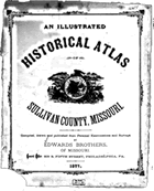
Historical Atlas of Sullivan County Missouri

Neighboring Counties

Additional Information

See the Missouri Maps, Gazetteers & Geographical Information section on Cyndi's List.


Page last modified: hand03-01-20